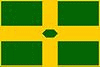
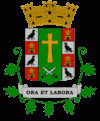
Patillas (Patillas Municipio)
 |
 |
Europeans had settled the area as early as 1760. There was, however, no permanent settlement until the town was officially founded in 1811. In 1841 a fire in Patillas killed a great many people.
Patillas is located along the southeastern coast of the main island of Puerto Rico. There was an establishment of a sugar cane mill which took advantage of the agricultural potential the coastal valley provided. As this establishment provided a good source of income for the neighbors it also was the main reason for the town's foundation in 1811. Doña Adelina Cintrón, owner of "La Finca Patillas", donated almost 8 acre of land for the foundation. Most of the neighbors then relocated tob the west side of the proposed site called Cacao Bajo.
Puerto Rico was ceded by Spain in the aftermath of the Spanish–American War under the terms of the Treaty of Paris of 1898 and became a territory of the United States. In 1899, the United States Department of War conducted a census of Puerto Rico finding that the population of Patillas was 11,163.
On September 20, 2017 Hurricane Maria struck the island of Puerto Rico. In Patillas, power was out and 341 homes were completely destroyed. Wind and rain triggered numerous landslides making roads inaccessible.
Map - Patillas (Patillas Municipio)
Map


Country - Puerto Rico
 |
 |
Currency / Language
| ISO | Currency | Symbol | Significant figures |
|---|---|---|---|
| USD | United States dollar | $ | 2 |
| ISO | Language |
|---|---|
| EN | English language |
| ES | Spanish language |